Guide · Guide to north Tenerife
Erjos, Los Silos and Monte del Agua walks: a guide to choosing
Monte del Agua walks from Erjos and Los Silos: six official Teno trails compared by length, climb, difficulty, bus stops and access rules, so you can choose.
- 6 minread
- 29 October 2026checked
- 10sources
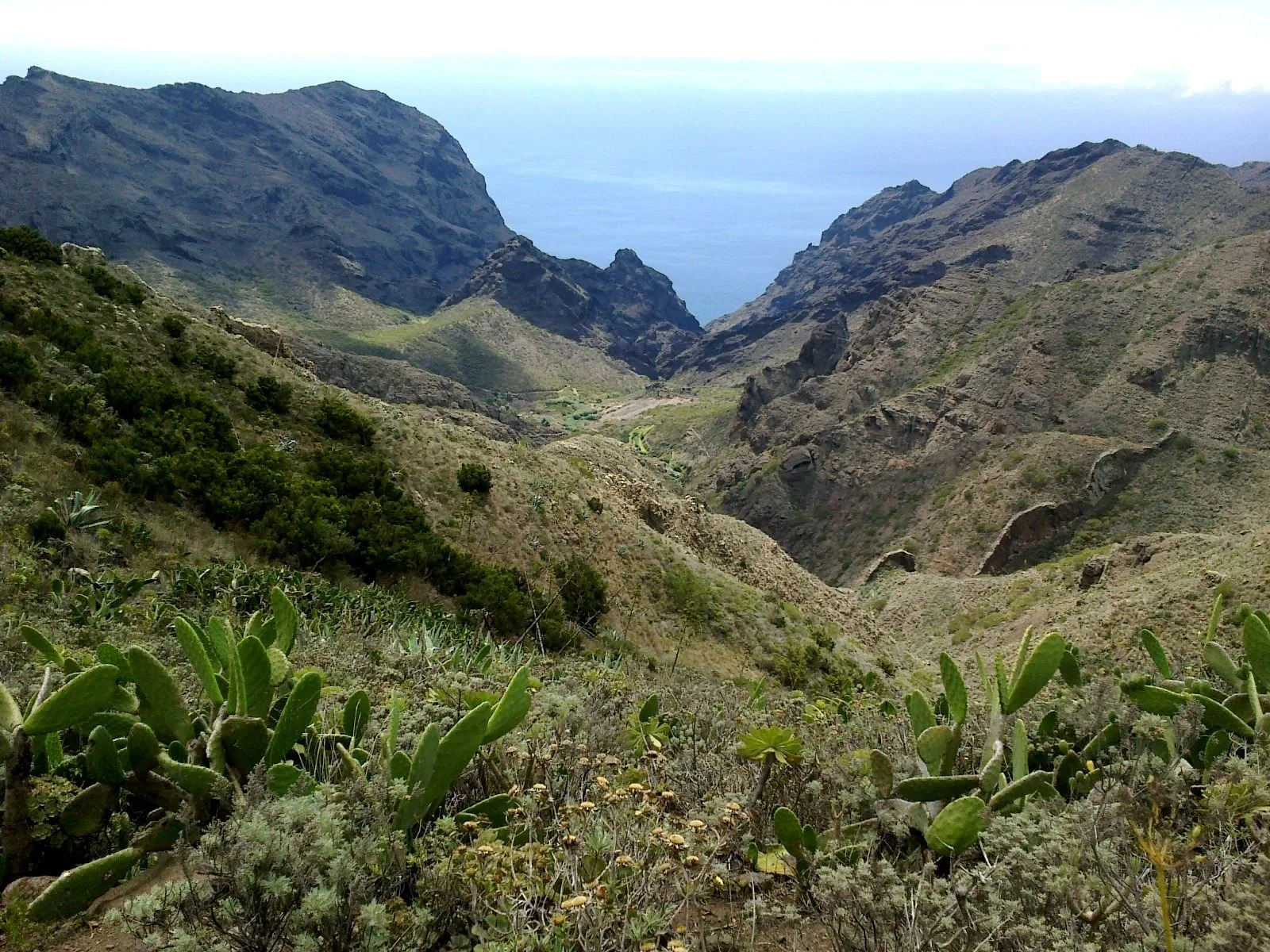
Erjos is a hamlet by the TF-82 road, at the edge of Monte del Agua, the laurel forest of Teno Rural Park. This guide covers five official trails that start there and a sixth that starts in Los Silos, down on the coast. If you are short of time, take the self-guided trail: 1.34 km and about 30 minutes to a viewpoint over the forest. To walk down to the coast, the PR-TF 53 via Cuevas Negras drops from Erjos to Los Silos in 5.24 km. On all of them, as of 29 October 2026, access is free with no booking.
For a short walk: the self-guided trail
It leaves the square in Erjos, passes houses and vegetable plots and climbs to the Monte del Agua forest track, where the landscape and the humidity change. It ends at a viewpoint you can only reach on foot, and you come back the same way. The listing gives 1.34 km, 30 minutes and low difficulty, with a little over 130 m of ascent. The Cabildo's leaflet explains it in seven stops, from the village's origins to trees such as laurel, tilo and viñátigo.
The last stretch is shared with the Monte del Agua accessible trail, which runs along the PR-TF 52 and PR-TF 54 and whose figures Tenerife ON does not yet publish. Note: the listing's data sheet puts the start at Plaza Grande; its description and the leaflet, at Plaza Nueva.
The loop via the Charcas de Erjos
It is the only loop of the six: 9.26 km, about 758 m of ascent and the same in descent, high difficulty. It starts on Calle Las Cruces, first follows the PR-TF 51 to the Charcas de Erjos ponds and enters Monte del Agua via Fuente de Los Loros. It returns to Erjos on the PR-TF 52. The ponds are old open-pit quarries: according to the Cabildo, they were worked in the 1970s and 1980s for earth and aggregates, and rainwater now collects in the hollows.
Note: the section from Fuente de Los Loros is not waymarked, although the path is easy to see. The timings do not match either: the data sheet says 4 hours, the description about two and a half. Plan on 4 hours.
Erjos down to Los Silos: PR-TF 53 or PR-TF 54
Both leave from the Sagrada Familia chapel on Calle La Unión and finish at the church square in Los Silos. Both are rated medium and are mostly downhill: according to the listings, 1,500 and 1,569 m of cumulative descent.
- PR-TF 53, via Cuevas Negras: 5.24 km, 3 h 10 min. It crosses the laurel forest and drops down the Cuevas Negras ravine on an old royal road that linked Los Silos with Santiago del Teide, cobbled in places. It passes the hamlet of Cuevas Negras and crosses two wooden footbridges before the square.
- PR-TF 54, via Las Moradas: 11.30 km, 4 h 50 min. It first follows the Monte del Agua track and after 4 km turns off to drop to Las Moradas Altas, with views over the cloud forest. Much of it is on the cobbles of another royal road; it passes Las Moradas Bajas, an abandoned hamlet, and ends at the church square.
The long traverse: PR-TF 52 to Las Portelas
10.69 km, 4 h 25 min and high difficulty. It leaves from the same chapel with views of Erjos and Teide behind, soon enters the laurel forest and heads north-west along the eastern side of the El Palmar valley. Once Las Portelas comes into view in the distance, farming terraces appear, and the trail ends in that hamlet.
From Los Silos: PR-TF 55 to El Palmar
This one does not touch Erjos: it climbs from the south of Los Silos town on a cobbled path to the abandoned houses of Talavera, with views of Monte del Agua and the El Palmar valley, then drops to Plaza de Las Libreas. 5.10 km, 2 h 50 min, medium difficulty and about 700 m of ascent.
Buses, access and precautions
According to Tenerife ON, TITSA routes 325, 392 and 460 serve Erjos, stop Erjos (4668). At the end of the PR-TF 53 and PR-TF 54, in Los Silos, the 363 stops at 4453. At the end of the PR-TF 52, in Las Portelas, the 355, 365 and 366 stop at 4549. The PR-TF 55 starts about a 10-minute walk from stop 4454 (route 363) and ends by stop 4544 in El Palmar. On linear routes, plan the return before you set off.
- Stay on the waymarked trail and keep out of water galleries, wells and caves.
- Ravines with water, loose rock and steep slopes: the listings ask for care.
- Parking in Erjos is limited, according to the self-guided trail listing.
- Emergencies: 112.
- Erjos–Monte del Agua self-guided
- 1.34 km · 30 min (one way) · low · out and back
- Loop via Fuente Los Loros
- 9.26 km · 4 h · high · +758 m · Calle Las Cruces
- PR-TF 52 Erjos–Las Portelas
- 10.69 km · 4 h 25 min · high · linear
- PR-TF 53 via Cuevas Negras
- 5.24 km · 3 h 10 min · medium · −1,500 m
- PR-TF 54 via Las Moradas
- 11.30 km · 4 h 50 min · medium · −1,569 m
- PR-TF 55 Los Silos–El Palmar
- 5.10 km · 2 h 50 min · medium · +702 m
- Bus to Erjos
- TITSA 325, 392 and 460 · stop 4668
- Booking
- not needed for visitors
- Protected area
- Teno Rural Park
From Finca Julia
Erjos lies west of Icod and Los Silos lies below on the Isla Baja coast. The self-guided trail fits into a short morning; the linear routes take from almost 3 to almost 5 hours according to the listings, plus the bus back. Bring a warm layer and a waterproof even if Icod is sunny: the Cabildo describes the forest as cool and damp. If you drive, the loop and the self-guided trail end where you parked; after a linear walk you will need a bus back to the car.
The trails that do need booking
Do you need a car in Tenerife?
Frequently asked questions
Do you need to book Monte del Agua?
No. As of 29 October 2026, every Tenerife ON listing gives free access with no booking for visitors.
Which is the easiest Erjos walk?
The Erjos–Monte del Agua self-guided trail: 1.34 km and about 30 minutes to the viewpoint, low difficulty; you return the same way.
What are the Charcas de Erjos?
Rainwater ponds in old aggregate quarries worked in the 1970s and 1980s. The loop via Fuente de Los Loros and the PR-TF 51 pass them.
Finca Julia is a few minutes from all of this.
Check availability on Airbnb — Opens the official Airbnb listing in a new tabSources
- Tenerife ON (Cabildo) — Erjos–Monte del Agua Self-guided Trail ↗
- Tenerife ON (Cabildo) — Folleto del sendero autoguiado Erjos–Monte del Agua (PDF) ↗
- Tenerife ON (Cabildo) — SA-PRT 01 Sendero accesible Monte del Agua ↗
- Tenerife ON (Cabildo) — Sendero circular Erjos–Monte del Agua por Fuente Los Loros ↗
- Tenerife ON (Cabildo) — PR-TF 52 Erjos–Las Portelas ↗
- Tenerife ON (Cabildo) — PR-TF 53 Cuevas Negras ↗
- Tenerife ON (Cabildo) — PR-TF 54 Las Moradas ↗
- Tenerife ON (Cabildo) — PR-TF 55 Talavera ↗
- Turismo de Tenerife — PR-TF 52 Erjos–Las Portelas (Monte del Agua) ↗
- Turismo de Tenerife — PR-TF 54 Los Silos–Las Moradas–Monte del Agua ↗
Updated on: · Reviewed on:
This guide is written from a house in Icod.
Finca Julia is a Canarian house for four in the hills above the town. Availability and price are on the official listing.
Plans
Plans that pass through here
Experiences and itineraries that share places with this page.
- PlanBlack, blue and lavaThe black sand of San Marcos, the rock pools of El Caletón and the badlands of Chinyero: the coast and the volcano that made it, on a dry day without a swell.
- PlanA day on Guayota's volcanoThe volcano the Guanches linked to hell, the rocks on the 1,000-peseta note and the Eggs of Teide. A full day, on a clear day.
- PlanFrom the volcano to the AtlanticUp to Teide in the morning, the whole island from La Rambleta at 3,555 metres, and down to swim at San Marcos in the afternoon. Only possible from the north.
- DayA whole day without getting in the carWhat you can do in Icod on foot and by bus: the old town, the dragon tree, the beach and the TITSA lines through the town's station.
Keep reading
The whole guide© rene boulay · CC BY-SA 3.0 5 min read
Teno Alto: getting there, parking and which trails to walk
© H. Zell · CC BY-SA 3.0 6 min read
Los Gigantes cliffs: where to see them and how to get there from the north
© Josefir Instantes · CC BY-SA 4.0 2 min read
Walks near Icod
Finca Julia · Icod de los Vinos
And at the end of the day,
the terrace.
An old Canarian house on the hillside, with the Atlantic in front. Availability and price are on the official Airbnb listing.