Guide · Guide to north Tenerife
Los Gigantes cliffs: where to see them and how to get there from the north
Los Gigantes cliffs, up to 600 m high: where to see them (viewpoints, Los Guíos beach, by boat), how they are protected and the route from the north.
- 6 minread
- 30 October 2026checked
- 13sources
The Los Gigantes cliffs are a wall of volcanic rock dropping sheer into the sea in Santiago del Teide, on Tenerife's west coast. They reach 600 metres high, according to Turismo de Tenerife, and mark the south-western edge of Teno Rural Park. You get a good view from land, from the Archipenque viewpoint and the seafront walk in the town of Los Gigantes, and from Los Guíos beach at their foot. According to Turismo de Tenerife, seeing them from the sea is one of the best ways to take in their height. From the north you reach them on the TF-82, which runs through Icod and Erjos.
What the Los Gigantes cliffs are
They are the great natural landmark of Santiago del Teide. The wall drops straight to the water and, at its foot, the seabed lies around 30 metres down, a figure Turismo de Tenerife gives because of its appeal for diving and fishing.
They belong to the Teno massif, the island's north-western tip. Tenerife ON, the Cabildo's natural areas website, dates the park's rocks to between 6 and 7 million years old and calls these cliffs an emblem of the park and of Tenerife.
Where to see them from land
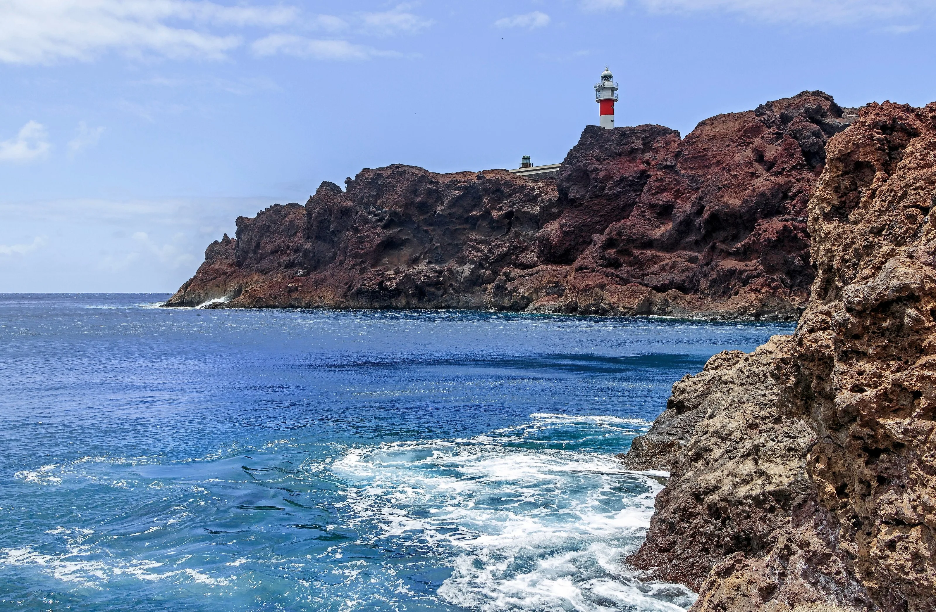
Archipenque viewpoint. It sits on the road down to Puerto Santiago, at km 6 of the TF-454. It has parking, interpretation panels and step-free access, but no bus stop. From there you see the cliffs, the seaside town and its harbour and, beyond, La Gomera. To the right you can make out the Punta de Teno lighthouse. It is a good spot for sunset.
Cliff viewpoint in the town of Los Gigantes. In 2015 the Cabildo, with funding also from the town council, finished a pedestrian walk running parallel to the coast, between Calle La Hondura and Calle Hibisco, with parking alongside, shaded seating and a cantilevered glass railing. The steps were removed so you can walk it without barriers.
Punta de Teno. From its viewpoint, at the other end of the massif, you see the cliffs to the south. Access to Punta de Teno has its own rules: we explain them in the Punta de Teno and Masca guide.
On foot. Turismo de Tenerife mentions several routes from Masca or Puerto Santiago. The PR-TF 65 runs down from Santiago del Teide to Puerto Santiago and is rated intermediate. The PR-TF 65.1 goes from Plaza de El Molledo to Risco Blanco: 2.35 km, linear and low difficulty.
Los Guíos beach and the harbour
Los Guíos beach, also known as Argel, sits at the foot of the cliffs next to the Los Gigantes harbour. It is black sand, about 180 metres long and 20 wide, and Turismo de Tenerife describes its water as calm. It is an easy walk in, but it has no parking of its own and no adapted access. There are bins, municipal cleaning and bars nearby, and the intercity bus reaches the area.
If you want more sand, Turismo de Tenerife picks out La Arena beach in Puerto Santiago, with volcanic black sand. There are also small natural pools at points along the coast.
Seeing them from the sea
Turismo de Tenerife reckons a boat trip is one of the best ways to take in their height. According to its page on the municipality, whale- and dolphin-watching boats leave the marina all year round, and there are also short coastal trips, kayaking and snorkelling. We do not recommend operators: compare and book calmly.
Whale watching has rules. In the Canary Islands it is regulated by the Canary Government's Decree 178/2000. Across Spain, Royal Decree 1727/2007 sets an exclusion zone with a radius of at least 60 metres around each cetacean or group. It bans feeding them and, inside that exclusion zone, swimming or diving. It also applies to private individuals, commercial or not.
Protected on land and at sea
On land, the cliffs are part of Teno Rural Park (code T-13 in the Canary network), covering 8,063.6 hectares across Buenavista del Norte, Los Silos, El Tanque and Santiago del Teide. Its management plan places the sea cliffs running from Masca beach to Los Gigantes in a moderate-use zone. The same plan notes that the Teno massif was also included in the network of Special Protection Areas for Birds (SPAs).
At sea, the west coast lies within the Franja marina Teno-Rasca Special Area of Conservation (ES7020017), part of the Natura 2000 network, designated in September 2011. According to the information panel published by Spain's Ministry for the Ecological Transition, it covers 69,489.68 hectares, protects sea caves, reefs and sandbanks, and is home to loggerhead and green turtles and bottlenose dolphins. Up to 22 species of cetaceans have been recorded. Disturbing cetaceans and turtles is prohibited.
Getting there from the north: Erjos and Santiago del Teide
Turismo de Tenerife puts it simply: from the north, the usual route goes through Icod de los Vinos and the TF-82. The road linking El Tanque with Santiago del Teide passes Ruigómez and Erjos, which sits by the TF-82. Santiago del Teide is a village at around 900 metres. From there you head down to the coast; at km 6 of the TF-454, on the way to Puerto Santiago, is the Archipenque viewpoint. They warn that the roads here have plenty of bends.
By bus, the Cabildo's route catalogue lists the 325, Puerto de la Cruz – Icod – Los Gigantes. We do not give timetables: check them with TITSA before you go.
- Height
- up to 600 m
- Municipality
- Santiago del Teide
- Archipenque viewpoint
- TF-454, km 6 · parking · no bus stop
- Los Guíos beach
- black sand · 180 × 20 m · no parking
- From the north
- Via Icod and the TF-82, past Erjos
- Bus from Icod
- TITSA route 325
- Protection on land
- Teno Rural Park (T-13) · SPA
- Protection at sea
- Franja marina Teno-Rasca SAC (ES7020017)
- Whale watching
- Decree 178/2000 · RD 1727/2007 · 60 m minimum
- Best time, per Turismo de Tenerife
- November to May
From Finca Julia
Icod is on the TF-82, the same road Turismo de Tenerife gives as the usual route from the north. You can make a day of it: a stop in Erjos for a walk in Monte del Agua, down through Santiago del Teide and sunset at Archipenque. Bring a warm layer for the high ground and sun protection for the coast.
Erjos and Monte del Agua walks
Frequently asked questions
How high are the Los Gigantes cliffs?
Up to 600 metres above the sea, according to Turismo de Tenerife. At their foot, the seabed is around 30 metres deep.
Which is the best viewpoint?
Turismo de Tenerife points to Archipenque, on the TF-454 heading down to Puerto Santiago. It has parking and step-free access. Down in the town, the cliff viewpoint walk shows them up close.
Can you get there by bus from Icod?
According to the Cabildo's route catalogue, yes: TITSA route 325 links Puerto de la Cruz, Icod and Los Gigantes. Check the route and timetable with TITSA before you set off.
When is the best time to go?
Turismo de Tenerife suggests autumn to spring if you want mild weather: from November to May temperatures are usually between 20 and 23 °C. July and August are hotter and can top 30 °C.
Finca Julia is a few minutes from all of this.
Check availability on Airbnb — Opens the official Airbnb listing in a new tabSources
- Turismo de Tenerife — Acantilados de Los Gigantes ↗
- Turismo de Tenerife — Santiago del Teide ↗
- Turismo de Tenerife — Mirador de Archipenque ↗
- Turismo de Tenerife — Playa de Los Guíos ↗
- Turismo de Tenerife (blog corporativo) — Obras del mirador del acantilado de Los Gigantes, 2015 ↗
- Turismo de Tenerife — Ruigómez, Erjos y caseríos de El Tanque ↗
- Turismo de Tenerife — PR-TF 52 Erjos–Las Portelas ↗
- Tenerife ON (Cabildo) — Parque Rural de Teno ↗
- BOC 2006/241 — Revisión parcial del Plan Rector de Uso y Gestión del Parque Rural de Teno ↗
- MITECO — ZEC Franja marina Teno-Rasca (ES7020017) ↗
- Gobierno de Canarias (Juriscan) — Decreto 178/2000, observación de cetáceos ↗
- BOE — Real Decreto 1727/2007, protección de los cetáceos ↗
- Cabildo de Tenerife, datos abiertos — Líneas y horarios de guaguas ↗
Updated on: · Reviewed on:
This guide is written from a house in Icod.
Finca Julia is a Canarian house for four in the hills above the town. Availability and price are on the official listing.
Plans
Plans that pass through here
Experiences and itineraries that share places with this page.
- DayThree days based in IcodIcod, Garachico and Teide in three days, with real drive times from the old town and without driving the same road twice.
- PlanFrom the volcano to the AtlanticUp to Teide in the morning, the whole island from La Rambleta at 3,555 metres, and down to swim at San Marcos in the afternoon. Only possible from the north.
- PlanBlack, blue and lavaThe black sand of San Marcos, the rock pools of El Caletón and the badlands of Chinyero: the coast and the volcano that made it, on a dry day without a swell.
- PlanA morning with children in IcodEight hundred butterflies under glass, a dragon tree you can do in twenty minutes and a beach with showers and black sand. Three stops within six minutes.
Keep reading
The whole guide© H. Zell · CC BY-SA 3.0 2 min read
Punta de Teno and Masca: how access works now
© rene boulay · CC BY-SA 3.0 6 min read
Erjos, Los Silos and Monte del Agua walks: a guide to choosing
© Quartl · CC BY-SA 3.0 2 min read
The north's viewpoints, by area, and what you see from each
Finca Julia · Icod de los Vinos
And at the end of the day,
the terrace.
An old Canarian house on the hillside, with the Atlantic in front. Availability and price are on the official Airbnb listing.